SEVERE THUNDERSTORM WATCH lifted 8/7/19


I know what I just said, but
Severe Thunderstorm Warning!!!
Severe Thunderstorm Warning
NJC003-013-017-031-039-071900-
/O.NEW.KOKX.SV.W.0060.190807T1818Z-190807T1900Z/
BULLETIN - IMMEDIATE BROADCAST REQUESTED
Severe Thunderstorm Warning
National Weather Service New York NY
218 PM EDT Wed Aug 7 2019
The National Weather Service in Upton NY has issued a
* Severe Thunderstorm Warning for...
Hudson County in northeastern New Jersey...
Eastern Passaic County in northeastern New Jersey...
Union County in northeastern New Jersey...
Southeastern Bergen County in northeastern New Jersey...
Essex County in northeastern New Jersey...
* Until 300 PM EDT.
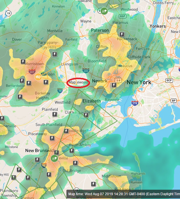
* At 217 PM EDT, a severe thunderstorm was located over Millington,
or near Morristown, moving east at 25 mph.
HAZARD...60 mph wind gusts and quarter size hail.
SOURCE...Radar indicated.
IMPACT...Minor hail damage to vehicles is possible. Expect wind
damage to trees and power lines.
* This severe thunderstorm will be near...
Plainfield around 230 PM EDT.
Summit around 245 PM EDT.
Millburn and Clark around 250 PM EDT.
Newark and Elizabeth around 300 PM EDT.
PRECAUTIONARY/PREPAREDNESS ACTIONS...
For your protection move to an interior room on the lowest floor of a
building.
To report severe weather, contact your nearest law enforcement
agency. They will send your report to the National Weather Service
office in Upton NY.
Torrential rainfall is occurring with this storm, and may lead to
flash flooding. Do not drive your vehicle through flooded roadways.

Flash Flood Warning
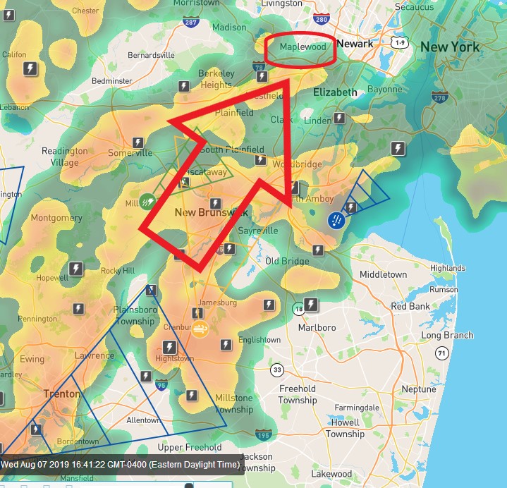
Flash Flood Warning
NJC003-013-017-031-039-072145-
/O.NEW.KOKX.FF.W.0023.190807T1849Z-190807T2145Z/
/00000.0.ER.000000T0000Z.000000T0000Z.000000T0000Z.OO/

BULLETIN - EAS ACTIVATION REQUESTED
Flash Flood Warning
National Weather Service New York NY
249 PM EDT Wed Aug 7 2019

The National Weather Service in Upton NY has issued a

* Flash Flood Warning for...
  Hudson County in northeastern New Jersey...
  Eastern Passaic County in northeastern New Jersey...
  Eastern Union County in northeastern New Jersey...
  South central Bergen County in northeastern New Jersey...
  Eastern Essex County in northeastern New Jersey...

* Until 545 PM EDT.

* At 249 PM EDT, Doppler radar indicated thunderstorms producing
  heavy rain across the warned area. Flash flooding is expected to
  begin shortly.

* Some locations that will experience flooding include...
  Newark, Elizabeth, Passaic, Bloomfield, Linden, Orange, Lyndhurst,
  Rutherford, Secaucus, Harrison, Ridgefield, Union City, Kearny,
  Union and Teterboro.


Got caught in it in West Orange. Water coming down in buckets. Seems to have passed for now... Temperature dropped 12 degrees.
These storms have passed but the likelihood of further storms exists and the Watch remains in effect until 9:00pm
I had intentions of going from Maplewood to Jersey City around 5:00. Would that be a mistake?


STANV said:
I had intentions of going from Maplewood to Jersey City around 5:00. Would that be a mistake?
How much do you dislike driving in the rain?
max_weisenfeld said:
How much do you dislike driving in the rain?
I'm staying home. Thanks.

Jaytee said:
Any info on a tornado touching down in Springfield?
No. I would be very very surprised if this system threw off a tornado. There was no sign of rotation in this storm at all. However, there were some pretty impressive straight-line winds, so maybe that's what they ssaw.
max_weisenfeld said:
Jaytee said:
Any info on a tornado touching down in Springfield?
No. I would be very very surprised if this system threw off a tornado. There was no sign of rotation in this storm at all. However, there were some pretty impressive straight-line winds, so maybe that's what they ssaw.
Looks like I may have been wrong about that...

CBS News just showed images of the aftermath of a tornado touching down in Springfield.
Not saying Tapinto is the most reliable source ... I have not been able to find a confirmation on this from the NWS.

I saw a video of it. The news story said it was the sixth tornado so far this year in NJ. (Normal is 2 per year for the state.)
joan_crystal said:
CBS News just showed images of the aftermath of a tornado touching down in Springfield.
People are saying it touched down around rte 22 and the Springfield Ave intersection. I know a lot of people have lost power.
sac said:
I saw a video of it. The news story said it was the sixth tornado so far this year in NJ. (Normal is 2 per year for the state.)
Yes it's getting to be some regular occurrence this year. Unnerving.

the freaking racquetball courts at the jcc flooded today. plus livingston shoprite parking lot. never seen either of those happen before.
it's the apocalypse.
You are the bestest, max! I go to NWS/NOAA first but always check in with you for the hyperlocal forcast.
Sponsored Business


Promote your business here - Businesses get highlighted throughout the site and you can add a deal.


There are, at the moment, thunderstorms on three sides of us but not actually here (the one east of us is really close, though, so you can hear the thunder).
Ok, I take that back, it is moving away but growing so fast it is also moving towards the eastern part of town!
SEVERE THUNDERSTORM WATCH until 9:00 pm tonight!