Irma -- Updated 9/11

Stop scaring people. The odds of this making landfall as a cat. 5 with 175 mph winds are slim to none. it also isn't currently forecast to make landfall in Tampa/st. Pete, and the most extreme wind in this storm extends out to maybe 30 miles. While you're right that nobody should try to ride out a major hurricane a block from the coast, this is not how you convey that message.
BG9 said:
conandrob240 said:
in South Florida now- coastal area of Treasure Island/St pete. Supposed to head to Disney Fri-Mon.
Not sure what to do. Hate to waste $ to be at Disney if services are suspended. Makes me a bit nervous to ride out a hurricane a block from the beach/intracoastal.
I wouldn't go, considering its a Cat 5. You may not even be able to get transportation to there. If by some miracle you do manage to get there then write your Soc Sec number on your arm with indelible ink.
The "F" scale was retired in 2007. This hurricane would be equivalent to an EF4.
Klinker said:
DottyParker said:
Tuesday morning, NOAA Hurricane Hunters found the storm’s maximum wind speeds are 175 mph. It now ranks among the strongest hurricanes ever recorded in the Atlantic Ocean. Forecasts suggest it will reach southern Florida and the Gulf of Mexico this weekend.
Wow.... If that was a tornado, it would be an F-3.
"F-3 158-205 mph, Severe damage, roofs and walls torn down, trains overturned, cars thrown around"

WxNut2.0 said:
Stop scaring people. The odds of this making landfall as a cat. 5 with 175 mph winds are slim to none. it also isn't currently forecast to make landfall in Tampa/st. Pete, and the most extreme wind in this storm extends out to maybe 30 miles. While you're right that nobody should try to ride out a major hurricane a block from the coast, this is not how you convey that message.
BG9 said:
conandrob240 said:
in South Florida now- coastal area of Treasure Island/St pete. Supposed to head to Disney Fri-Mon.
Not sure what to do. Hate to waste $ to be at Disney if services are suspended. Makes me a bit nervous to ride out a hurricane a block from the beach/intracoastal.
I wouldn't go, considering its a Cat 5. You may not even be able to get transportation to there. If by some miracle you do manage to get there then write your Soc Sec number on your arm with indelible ink.
I'll stand by what I wrote. The fact is its a very dangerous Cat 5, not even at the start border of Cat 5, but well into it. And its expected the intensity will increase. It will remain a Cat 5 for a couple of days and most likely not go below Cat 4 for the next 5 days.
The problem is we underestimated this storm's intensity. If there is even a 10% chance it can be disastrous, then you let people know so. You don't hide your head in the sand and keep that knowledge from them because you're afraid they will be scared.

Yeah, "we" didn't underestimate the intensity of this storm. You may have, but we didn't. We knew this thing had this kind of potential. We also know that intensity forecasts four days out are not reliable, and that landfall, by default, will decrease the strength significantly.
So you can stand by what you wrote all you want, but inciting hysteria gets us absolutely nowhere.
@Conandrob240: follow nhc.noaa.gov (@nhc_atlantic on twitter) for official updates and forecasts.
BG9 said:
WxNut2.0 said:
Stop scaring people. The odds of this making landfall as a cat. 5 with 175 mph winds are slim to none. it also isn't currently forecast to make landfall in Tampa/st. Pete, and the most extreme wind in this storm extends out to maybe 30 miles. While you're right that nobody should try to ride out a major hurricane a block from the coast, this is not how you convey that message.
BG9 said:
conandrob240 said:
in South Florida now- coastal area of Treasure Island/St pete. Supposed to head to Disney Fri-Mon.
Not sure what to do. Hate to waste $ to be at Disney if services are suspended. Makes me a bit nervous to ride out a hurricane a block from the beach/intracoastal.
I wouldn't go, considering its a Cat 5. You may not even be able to get transportation to there. If by some miracle you do manage to get there then write your Soc Sec number on your arm with indelible ink.
I'll stand by what I wrote. The fact is its a very dangerous Cat 5, not even at the start border of Cat 5, but well into it. And its expected the intensity will increase. It will remain a Cat 5 for a couple of days and most likely not go below Cat 4 for the next 5 days.
The problem is we underestimated this storm's intensity. If there is even a 10% chance it can be disastrous, then you let people know so. You don't hide your head in the sand and keep that knowledge from them because you're afraid they will be scared.

Is this all supposed to be funny? Or just the ink part? You "wouldn't go" where? I am tossing around whether to still go to Disney, stay in St Pete or bad it all and try to get home. I'm already here. Crowdsourcing a decision- WWYD?
BG9 said:
conandrob240 said:
in South Florida now- coastal area of Treasure Island/St pete. Supposed to head to Disney Fri-Mon.
Not sure what to do. Hate to waste $ to be at Disney if services are suspended. Makes me a bit nervous to ride out a hurricane a block from the beach/intracoastal.
I wouldn't go, considering its a Cat 5. You may not even be able to get transportation to there. If by some miracle you do manage to get there then write your Soc Sec number on your arm with indelible ink.
This was the wording that was used by officials leading up to Harvey as a means by which to scare people into leaving. BG9 decided to try to incite some panic too.
Here's what you need to know:
The hurricanes path is yet to fully be decided. It's not currently forecast to make landfall where you are. That said, it still very well could. Most of Florida is likely under the gun in some capacity. You probably don't want to stay a block from the beach, as if the storm approaches from the west, which it very well may, the storm surge will be bad. I'd imagine Disney probably will shut down either way.
Again, follow the national hurricane center for the best forecasts: nhc.noaa.gov.
Edited to add: this is a pretty big storm. And although the worst of it will be confined to close to the eye, significant impacts could be felt further out. So just because landfall may not occur where you are, doesn't mean significant weather won't.
conandrob240 said:
Is this all supposed to be funny? Or just the ink part? You "wouldn't go" where? I am tossing around whether to still go to Disney, stay in St Pete or bad it all and try to get home. I'm already here. Crowdsourcing a decision- WWYD?
BG9 said:
conandrob240 said:
in South Florida now- coastal area of Treasure Island/St pete. Supposed to head to Disney Fri-Mon.
Not sure what to do. Hate to waste $ to be at Disney if services are suspended. Makes me a bit nervous to ride out a hurricane a block from the beach/intracoastal.
I wouldn't go, considering its a Cat 5. You may not even be able to get transportation to there. If by some miracle you do manage to get there then write your Soc Sec number on your arm with indelible ink.
I think I'm convinced we need to leave the St Pete area by Thursday. The rest I'm not sure about what to do. Hubby is due to fly out of here Monday am to get to Pittsburgh so that is important. I stay until Tues and have no real work obligations ( can work remote) so I don't care if I get delayed.
Disney will close park's day of only. That is supposed to be Saturday now, correct? Our trip wasn't going to be park heavy- more centered around Food & Wine festival and nice dining. But I also don't want to pay $500/nt to sit in a locked down hotel. Hmmm...
That seems prudent to me. Yes, Saturday is when things should ramp up.
And for reference:

There's a real signal to noise problem leading up to events like this. Max does a good job giving you reliable info. But always defer to official hurricane center forecasts as a means by which to get the best information.

https://www.facebook.com/nbcnightlynews/videos/10155845254953689/
Al Roker, that paragon of forecasting, is calling for Irma scouring the Leeward Islands and Cuba, then a direct hit on southern florida, then turning north right through the state.


Long lines everywhere, for gas, for groceries, for water, if you can even find it. And this is days before Irma. People here in SoFla are taking this one very seriously.

Big IF and conjecture, but the models now seem to indicate a good possibility of a hit at the Everglades National Park, which would likely be the best outcome since it would keep the worst away from highly populated areas.

WxNut2.0 said:
The "F" scale was retired in 2007. This hurricane would be equivalent to an EF4.
Klinker said:
DottyParker said:
Tuesday morning, NOAA Hurricane Hunters found the storm’s maximum wind speeds are 175 mph. It now ranks among the strongest hurricanes ever recorded in the Atlantic Ocean. Forecasts suggest it will reach southern Florida and the Gulf of Mexico this weekend.
Wow.... If that was a tornado, it would be an F-3.
"F-3 158-205 mph, Severe damage, roofs and walls torn down, trains overturned, cars thrown around"
Curse you Google!
I'd leave but, then again, I would never go to Florida in the first place. Different humid, snake infested hell holes for different folks, I suppose.
I know Irma won't threaten Maplewood, but I'd be grateful if you weather experts would keep updating on likely impacts in Florida (and beyond). It's hard to filter the alarmists from the informed, and I trust Wxnut & Max for the straight scoop. Thanks!


Klinker said:
I'd leave but, then again, I would never go to Florida in the first place. Different humid, snake infested hell holes for different folks, I suppose.
Don't forget the giant flying cockroaches and the alligators.

And most of all, don't forget Florida Man.
marylago said:
Klinker said:
I'd leave but, then again, I would never go to Florida in the first place. Different humid, snake infested hell holes for different folks, I suppose.
Don't forget the giant flying cockroaches and the alligators.
marylago said:
Klinker said:
I'd leave but, then again, I would never go to Florida in the first place. Different humid, snake infested hell holes for different folks, I suppose.
Don't forget the giant flying cockroaches and the alligators.
Giant flying alligators! Oh my!! And here I thought the giant flying monkeys in The Wizard of Oz were scary!

I know it's still a bit early to say for sure, and the models are probably in disagreement on this, but I'm curious if the weather experts think there's much likelihood of this storm causing a rash of sharknados across Florida.

ril said:
I know Irma won't threaten Maplewood, but I'd be grateful if you weather experts would keep updating on likely impacts in Florida (and beyond). It's hard to filter the alarmists from the informed, and I trust Wxnut & Max for the straight scoop. Thanks!
Of course. Would be rather silly to keep posting about Irma and not mention Florida.
mfpark said:
marylago said:
Klinker said:
I'd leave but, then again, I would never go to Florida in the first place. Different humid, snake infested hell holes for different folks, I suppose.
Don't forget the giant flying cockroaches and the alligators.
Giant flying alligators! Oh my!! And here I thought the giant flying monkeys in The Wizard of Oz were scary!
That's why I put the "the" before alligators. But I guess I should have said, alligators and giant flying cockroaches. 
Tropical Storm Jose has been officially designated. It is at the moment well out in the central Atlantic and is no proximate threat to land.

Curiously enough, I think this storm may help spare Miami.
max_weisenfeld said:
Tropical Storm Jose has been officially designated. It is at the moment well out in the central Atlantic and is no proximate threat to land.
WxNut2.0 said:
There's a real signal to noise problem leading up to events like this. Max does a good job giving you reliable info. But always defer to official hurricane center forecasts as a means by which to get the best information.
Thank you. You advice is prudent, but the whole reason people follow threads like this is that the NHC advisories are not easy to read and understand. a lot of what i do is translating down from the more technical products to help people understand the statistical probabilities in lay terms and answer the question, 'What does this mean to me?'
This is not meant as a criticism of NOAA and NWS, or the academic community whose products I use.
It is a criticism of the media, but that is a conversation for another day.
WxNut2.0 said:
Curiously enough, I think this storm may help spare Miami.
max_weisenfeld said:
Tropical Storm Jose has been officially designated. It is at the moment well out in the central Atlantic and is no proximate threat to land.
Yes, the 12z runs have pulled back to the east a bit.
Absolutely. Wasn't meant as undermining you in any way. I would have people defer to them over anyone. But you're right, someone does often need to translate for them.
max_weisenfeld said:
WxNut2.0 said:
There's a real signal to noise problem leading up to events like this. Max does a good job giving you reliable info. But always defer to official hurricane center forecasts as a means by which to get the best information.
Thank you. You advice is prudent, but the whole reason people follow threads like this is that the NHC advisories are not easy to read and understand. a lot of what i do is translating down from the more technical products to help people understand the statistical probabilities in lay terms and answer the question, 'What does this mean to me?'
This is not meant as a criticism of NOAA and NWS, or the academic community whose products I use.
It is a criticism of the media, but that is a conversation for another day.
As of the latest model runs, Irma is still on track to effect the Leeward Islands tomorrow morning, Puerto Rico tomorrow evening, and either hit or pass very close to Haiti and the DR Thursday.
After that the cone of uncertainty widens as there are several other systems effecting the track, including a mid-Atlantic high pressure and Tropical Storm Jose.
Irma has slowed a bit, and should it hit Florida, which should be taken seriously but is no sure thing, the timing would be Saturday or Sunday for a south Florida hit, and a day later for the Orlando area.
Unfortunately, in the last 12 hours the track has become less clear, and the models are wavering in the 4 - 7 day window a bit more than they were.
Irma is a very powerful storm. The hit in the Caribbean is potentially catastrophic. Any passage over land, including the islands, will weaken the storm.

Actually, I love it here most of the time--humidity, alligators, crazy people and all (and we have plenty of all of those). I couldn't stand the cold, snow and endless winter of the northeast.
I am a little worried about an alligatornado-- that seems like a real possibility.
ril said:
Actually, I love it here most of the time--humidity, alligators, crazy people and all (and we have plenty of all of those). I couldn't stand the cold, snow and endless winter of the northeast.
I am a little worried about an alligatornado-- that seems like a real possibility.
I'd be worrying more about either the Snake-ado or the Leach-ado.... but that is just me and my phobias.
For Sale
-
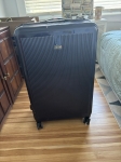
REVO luggage $100
More info


Garage Sales
-
House Contents Sale Sale Date: May 18, 2024
More info


Wow.... If that was a tornado, it would be an F-3.
"F-3 158-205 mph, Severe damage, roofs and walls torn down, trains overturned, cars thrown around"