Weird "gaslights" on the S-curves

They had tons of money: the feds kicked in $30 million for this project.

The extra lighting will also not be good for animals that live on the reservation.

The lights in the res are on county property. South Orange streets are in South Orange and the responsibility of the town. While I am against spending money for the sake of spending money, it isn't fair to say that the money should have been spent to update lighting on South Orange streets.


But why did they do the work in the first place? I understood it was to reduce the curves, but the curves are the same! Fun to drive through them though.


the drainage is improved and the curves are lessened. I like the lights. They look like the ones by Seton hall. I wish the work had been unnecessary, but if you spend 30 seconds watching people drive you can see why we need to be protected from ourselves. Poor driving skills plus lawyers equals projects like this.

I like the lights. In the daytime, when unlit, there do seem to be too many, but at night, when they're lit, they're fine. They're meant to make the road look more like a residential street than a highway.
We were away when the blizzard hit. In previous years, there would always be questions on MOL (usually on Max's thread) asking if the S - curves were open, when a weather event like that hit. Were the S-curves open?

FilmCarp said:
the drainage is improved and the curves are lessened. I like the lights. They look like the ones by Seton hall. I wish the work had been unnecessary, but if you spend 30 seconds watching people drive you can see why we need to be protected from ourselves. Poor driving skills plus lawyers equals projects like this.
FilmCarp. I was going to start a thread about the S curves, but never got to it, so I'll jump in here. I've lived in SO for over 30 years and I don't see a damn thing different about the severity of the S curves. Don't have photos or anything to prove it, but from driving it regularly, I don't see a thing different about the curves. Yeah, I know they improved the drainage, etc., but as for the curves, not so much. Not that I mind, always enjoyed driving them, so really just curious.
vermontgolfer - I completely agree! I drive them 3-4 times a week, and do not see any difference in the curves themselves. Also, does anyone know why when they widened everything, they did not make two lanes going towards Livingston?

lukeysboat said:
vermontgolfer - I completely agree! I drive them 3-4 times a week, and do not see any difference in the curves themselves. Also, does anyone know why when they widened everything, they did not make two lanes going towards Livingston?
I think it is because that would have required taking too much Green Acres land.
I'm a little hard-pressed to see the difference. Are they planning on continuing in Spring?


The S-curves aren't a residential street, no matter how many ye olde lamps you install. (Yes, I know there are houses off to the side on one stretch, but in no way is this a local street.) I love the reservation but the road through it would have been perfectly fine with simple, standard lighting. Good design makes sense, and fake gas lamps don't make any sense. My comment about using the money instead on SO's street lights was more of a frustrated aside. But you know what they could have done, had they not planted dozens and dozens of (no doubt expensive) faux lights? They could have maybe spent less money. Novel concept.
Agree on the curves, which I love driving always... and to do all that 30M worth of work they killed an awful lot of trees (tho planted a lot too) - seems wasteful.. Make work? taxpayer money?
Wondering? --Did they put in an overpass for deer?..culverts for turtles? or was it not a holistic enterprise? (I once saved a turtle trying to cross over- was wounded - survived ;-)

Having driven the S curves for almost 20 years, it was obvious that the east bound lane was falling into the ravine because of the poor drainage issues. The roadway was buckling and collapsing. Redesign has essentially moved the roadway away from the precipice and installed better drainage.
The $30 million was from the federal government - it was a take it or lose it proposition. The reason that I asked in my post above if the S-curves were open during the blizzard is that in the past whenever there had been a substantial rain or snowstorm the S-curves had to be closed because of poor drainage and/or ice. If the work did nothing more than to allow the S -curves to remain open under conditions that they would not have been open in the past, I think it was worth it.

Someone's pork project or they just have to spend the money ?
The curves are still there, just hope whatever drainage issues will be solved with money spent.
The pedestrian bridges have stone veneer and have arches, it's just going to be time before some tall trucks hit the low clearance sides of the arches. Also, I wonder how long before the cement in the veneer starts deteriorating with loose stones fall onto drivers below.
Hope they make a dedicated left turn lane at the light for Glenview Road when it's all over, or there will be impatient drivers trying to cut to the right lane at the last minute because someone stops to turn left into Glenview.
What's the logic in cutting to a single lane after Glenview going toward South Orange, and then opens up to two lanes further downhill. Hope they change that back to two full lanes after the light when done.
Don't care about particular kind of street lights as long as they are useful and not just decorative.
Been here since they did all the dumbing down from two lanes both ways to what we have now through the reservation. The only thing upgrading through the years has been squeezing traffic onto other roads, including the narrowing of South Orange Avenue through South Orange downtown.
Maybe the same person who designed the roads, entrances and exits for Livingston Mall did the design for this project too  .
.
Rivoli - I should have said that the faux gas lamps are meant to provide a more park-like setting, instead of "residential." .

cramer said:
lukeysboat said:
vermontgolfer - I completely agree! I drive them 3-4 times a week, and do not see any difference in the curves themselves. Also, does anyone know why when they widened everything, they did not make two lanes going towards Livingston?
I think it is because that would have required taking too much Green Acres land.
There was always room for a 2nd westbound lane, even on the old road. It looked to me as if there may have been 2 lanes in the past but they reduced it to 1 lane with a bunch of yellow stripes. I always assumed they did this for safety reasons. Going down the hill in bad weather is dangerous enough. Downhill and side-by-side in bad weather is a recipe for a bad outcome.
I'm sorry people have to be so negative. At the start of the project no one wanted to give up t he curves. Now people complain about the curves. And of course, let's assume the workmanship on the bridges is shoddy. There is no way anyone can assume the contractors were competent?
I'm not complaining, I like the curves, only that I recall the original release addressing 'softening' the curves. I just don't see a lot of 'softening'

Only think that concerns me.... the lamps on the eastbound lanes are protected by a steel guardrail. At present, there is nothing to protect the lamps on the westbound lanes from a car that hits ice and goes off the road.
Granted, construction is not complete.
I don't think critiquing a $30mm taxpayer funded project is particularly "negative"by MOL standards.
The Reservation is rustic or naturalistic reserve. It's not a city park. The faux gaslights beyond the residential, sidewalked area is odd.
The peace I've made is that, and I don't know this for sure, the folks in Newstead got improved pedestrian lighting/walk ways heading east down the hill as a result of Joey Ds friend getting a bigger contract that included unnecessary, arguably aesthetically inappropriate faux gaslights that are unnecessary in large parts of the improvement area.
This is a link to an article in 2014 about the project:
http://www.northjersey.com/news/work-begins-on-s-curves-1.998482
"Work started earlier this month to redesign the 1.6-mile stretch of
roadway, which runs through South Mountain Reservation. Changes include
realigning the road to reduce the sharpness of the curves, widening the
road so a shoulder can be created in the eastbound direction, and adding
retention swales along the side of the road. The swales will alleviate
flooding and reduce water runoff from the road into the reservation. A
new pedestrian bridge will be constructed over the road near the Girl
Scout camp, and the existing pedestrian and equine bridges will be
reconstructed. The two bridges will be designed with stone facing to
complement the natural area of the reservation, according to Essex
County officials.
Other modifications include installing guard rails and lighting
along the road with traditional overhead cobra-head street lights and
decorative gas-lamp style lamps, upgrading the turnoff and parking areas
along the road, making it easier for motorists to enter and exit from
them, and upgrading the traffic signal equipment at the intersections of
South Orange Avenue and Brookside Drive/Cherry Lane in Millburn and
South Orange Avenue and Glenview Road in South Orange.
"DiVincenzo has been working toward getting federal funding for the
project for the past 10 years, since the Federal Highway Administration
had identified this section of South Orange Avenue, which runs from
Brookside Drive to Harding Drive, as deficient because the road floods
regularly and is usually closed to traffic during inclement weather. The
sharp curves in the road and the lack of a shoulder result in limited
sight lines, and make it difficult for motorists to enter and exit
existing turnoff areas."
"Whenever it snows, we have to immediately close the road," DiVincenzo said.
"According to Fontoura, more accidents have occurred on this stretch of
the road than any other county road."
eta - Couldn't get the link to work.

Yes, there were two lanes westbound at one time. And between going downhill, no shoulder and people speeding, it was nerve racking to drive, especially at night, or in inclement weather. It was shifted to one lane for safety reasons as vermontgolfer states, making it far safer.
And while I have no proof here, the curves do seem gentler than they were, at least in my assessment.
Rob_Sandow said:
cramer said:
lukeysboat said:
vermontgolfer - I completely agree! I drive them 3-4 times a week, and do not see any difference in the curves themselves. Also, does anyone know why when they widened everything, they did not make two lanes going towards Livingston?
I think it is because that would have required taking too much Green Acres land.
There was always room for a 2nd westbound lane, even on the old road. It looked to me as if there may have been 2 lanes in the past but they reduced it to 1 lane with a bunch of yellow stripes. I always assumed they did this for safety reasons. Going down the hill in bad weather is dangerous enough. Downhill and side-by-side in bad weather is a recipe for a bad outcome.


I was on them for the first time since they were completed. I definitely see a difference. The lanes are wider, easier to drive. Less scary when someone next to you doesn't know how to handle them.

marylago said:
I was on them for the first time since they were completed. I definitely see a difference. The lanes are wider, easier to drive. Less scary when someone next to you doesn't know how to handle them.
I agree. They never said that they were going to eliminate the curves (and that wasn't going to be possible), but they are a bit more "relaxed" than they were. I was surprised that they didn't restore the second westbound lane, though. I like the lamps except that it seems that there are about two or three times as many as needed i.e. they are too close together. I really wish that they could have, instead, extended them up the hill on the other side of Cherry Lane (i.e. still in the reservation.) I also would have liked to see another footbridge up there. There is a trail that crosses the road in that section and it is quite dangerous for pedestrians. I know, that wasn't part of the "S Curves" but it is in the reservation and Essex County, so I think it could have been included if someone had thought of it. (Since it seems like they had more money than they knew what to do with on the project.)
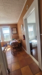

I drove on the s-curves of S. O. Ave. today for the first time in a long time, and noticed that they've installed lighting all along the new road. Along with standard tall highway lights, they've put in an inordinate number of replica S.O. "gaslights." I assume they're actually electric lights, but they're styled to look just like our gaslights. Whose awful idea was this?? Not to put too fine a point to it, installing fake gaslights along what's essentially a highway is the epitome of stupid design. Plus they've put in a truly ridiculous number of them, crammed between the perfectly fine standard highway lights. If they (whoever "they" is/are) have extra money to throw away on faux gaslights, why don't they spend it to light S.O.'s streets, many of which are so damn dark you need a headlight to walk safely.