Severe Weather threat for Tues 6/23


NWS has this:
Short term /6 am Tuesday morning through Tuesday night/...
departing mesoscale convective system across New England will complicate forecast some
for Tuesday ahead of an approaching cold front...as mostly cloudy
skies could be present for the first part of the day...in addition
to a few lingering showers/T-storms early as the warm front lifts
north. By late morning...expect breaks in clouds and gusty SW flow
to push temperatures to around or just above 90 in NYC...lower 90s across
NE New Jersey and middle to upper 80s elsewhere. Heat indices will peak
around 95 in NYC and in the upper 90s in NE New Jersey...and around 90
elsewhere. This will generate moderate instability ahead of the
cold front...with model forecast convective available potential energy of near or just above 2000 j/kg
especially just inland. After a several hour break middle day...the
front will begin to touch off scattered showers/T-storms which
will progress from northwest to southeast across the region beginning inland
during the early-middle afternoon. Given the instability in place and
40-50 knots of 0-6 km shear forecast by the models...severe T-storms
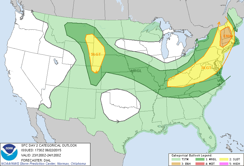
are forecast...with the Storm Prediction Center placing the entire
region in a slight risk. While an isolated tornado cannot be ruled
out...damaging winds and perhaps some large hail appear to be the
main threats.
Cold front and associated T-storms will push southeast of the region during
the early evening hours Tuesday with clearing behind the front. A
drier airmass will be ushered into the region as well with
lowering humidity.
There will be a moderate risk of rip currents at ocean beaches on
Tuesday.

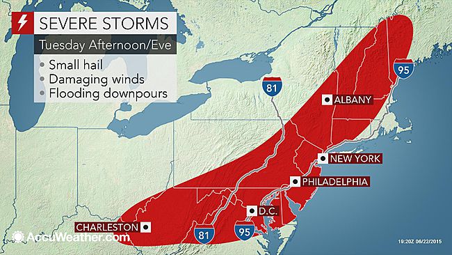
Accuweather: http://www.accuweather.com/en/weather-news/severe-storms-to-blast-philly/49093541

There is a good chance of thunderstorms tomorrow afternoon, and a very slight chance they will be severe in our area. Not too worried, but keeping an eye on it.
This is very much a short-term thing. Very hard to call it more than an hour or two out, and possibly less. With the low probability of severe weather here, I would just keep the radio on in case of alerts.
Accuweather, as usual, over-hype it.
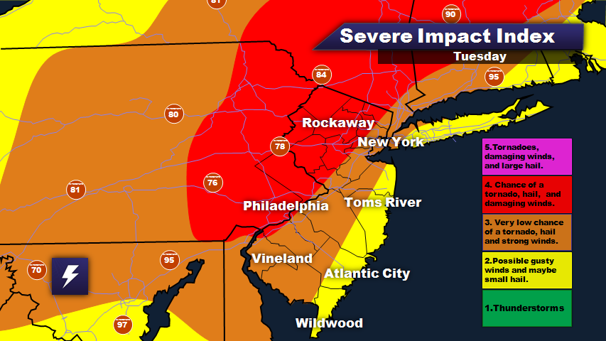
I do not know whose map that is in Jamie's OP, but note that he talks about a level 4 (on his own personal scale) but we are not in a level 4 zone on his map, but level 3.

Looks like it was tweeted out by NJ Weather Center (who knows who they are- they don't look very reputable):
http://njweathercenter.weebly.com/
The NWS has upgraded the severe thunderstorm risk to "enhanced." See the graphic below:
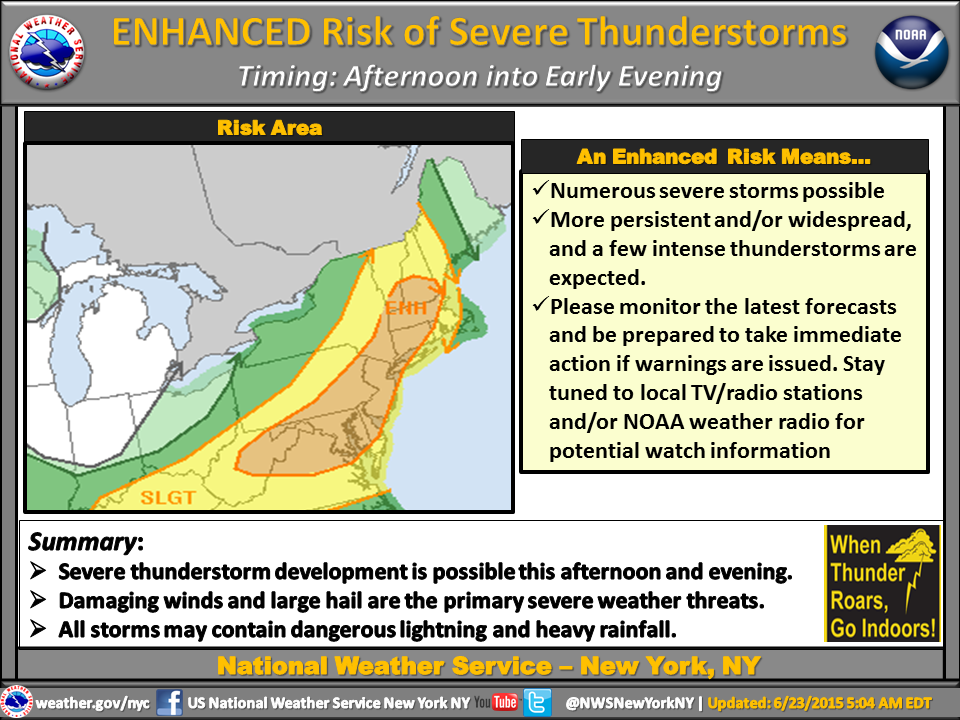
The weather will come in two waves, with the severity of this afternoon's storms dependent to a fair extent on what happens after this morning's storms pass. The first line of storms is developing in central PA now, and will arrive mid-morning. I do not expect these to be severe, but more like regular thunderstorms, with some wind and of course lightning. After they pass, if the sky clears and it gets hot, the storms that come with this afternoon's cold front could be, as the NWS says, "enhanced."

For Sale


Free Items

Sponsored Business


Promote your business here - Businesses get highlighted throughout the site and you can add a deal.

Just saw this on Facebook - any thoughts from our weather guys?